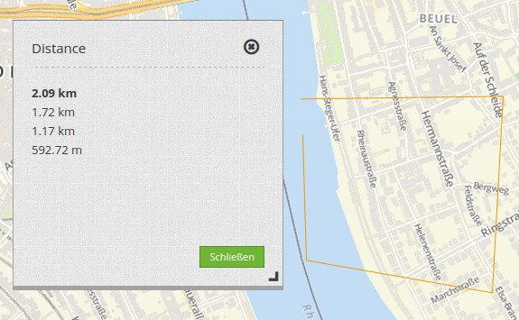
Line/Area Ruler
The ruler is used to draw a line or area and display length/area in a dialog.Selecting a type determines whether the element measures lines or areas. Each Ruler-element can only measure either lines or areas.
Configuration
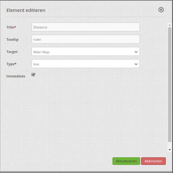
- Title: Title of the element. The title will be listed in “Layouts” and allows to distinguish between different buttons. It will be indicated if “Show label” is activated.
- Tooltip: text to use as tooltip.
- Target: Id of Map element to query.
- Type: choose type of element: line or area.
- Immediate: Select whether the calculated lengths are displayed immediately or only after the click in the map.
YAML-Definition:
tooltip: "ruler"   # text to use as tooltip
target: ~          # Id of Map element to query
type: 'line'       # choose type line or area
immediate: 'false' # True: Display the calculated lengths immediately. False: The calculated lengths are displayed only after clicking. Default: False.
You need a button to show this element. See Button for inherited configuration options. To use both functions (measuring areas and lines) in an application, you need two buttons that are in a group.
Class, Widget & Style
- Class: Mapbender\CoreBundle\Element\Ruler
- Widget: mapbender.element.ruler.js, subclasses mapbender.element.button.js
- Style: mapbender.elements.css
HTTP Callbacks
None.