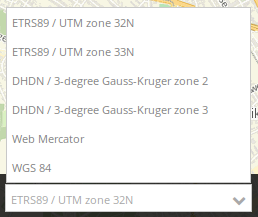
Spatial Reference System Selector (SRS Selector)
The spatial reference system selector changes the map’s spatial reference system. Notice: The Selectbox offers the SRS that are defined for the map element.
Configuration
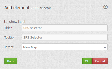
- Show label: indicates the element.
- Title: Title of the element. The title will be listed in “Layouts” and allows to distinguish between different buttons. It will be indicated if “Show label” is activated.
- Tooltip: text to use as tooltip.
- Target: Id of Map element to query.
YAML-Definition:
tooltip: 'SRS Selector'  # text to use as tooltip
label: false             # true/false to label the srs selector, default is false
target: ~                # Id of Map element to query
Class, Widget & Style
- Class: Mapbender\CoreBundle\Element\SrsSelector
- Widget: mapbender.element.srsselector.js
- Style: mapbender.elements.css
HTTP Callbacks
None.