Coordinates Display
The element shows your mouse position in map coordinates. The coordinates are dependent on the selected spatial reference system which may be changed with the SRS Selector element. Used together with Coordinates Display gives the added functionality of being able to switch between different coordinate systems.
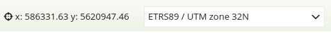
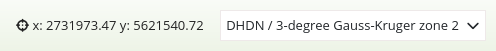
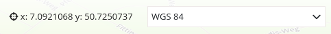
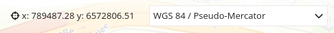
The coordinates display for different coordinate systems looks like this:
ETRS89 / UTM zone 32N (EPSG:25832):
DHDN / 3-degree Gauss-Kruger zone 2 (EPSG:31466):
WGS 84 (EPSG:4326):
WGS 84 / Pseudo-Mercator (EPSG:3857):
Configuration
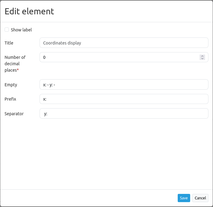
Show label: Show a label which incorporates the title and appears next to the coordinates.
Title: Title of the element. It will appear next to the coordinates if “Show label” is activated.
Number of decimal places: Number of decimal digits of the coordinates.
Empty: Text displayed when the mouse is not on the map (default: ‘x = - y = -‘).
Prefix: Prefix in front of the X coordinate (default: ‘= x’).
Separator: Separator in between the X coordinate and Y coordinate (default: ‘ y= ‘).
Position: Position (mandatory field, only when used in Map area). Options: ‘left-top’, ‘right-top’, ‘left-bottom’, ‘right-bottom’.
YAML-Definition
This template can be used to insert the element into a YAML application.
numDigits: 2                   # the number of digits each coordinate shall have when being rendered (default: 2)
target: map                    # id of Map element to query
label: true                    # true/false to label coordinates display (default: false)
empty: 'x= - y= -'             # show this text if the mouse is not on the map
prefix: 'x= '                  # show prefix before x coordinate
separator: ' y= '              # show separator before y coordinate
anchor: 'right-bottom'         # Position (only when used in Map area). Options: 'left-top', 'right-top', 'left-bottom', 'right-bottom'
CSS-Styling
The element can be customized with the following CSS-style, for example to increase the width.
.mb-element-coordsdisplay {
    width: 500px;
}