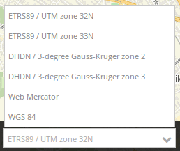
Spatial Reference System Selector (SRS Selector)
The spatial reference system selector changes the map’s spatial reference system. The selectbox offers SRS that are defined within the map element.
Configuration
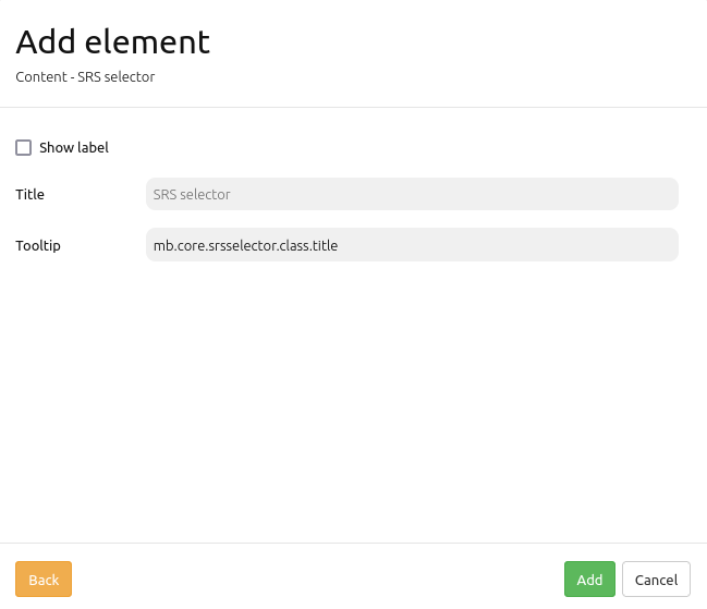
Show label: Labels the SRS Selector (Default: false).
Title: Title of the element. The title will be listed in “Layouts” and allows to distinguish between different buttons. It will be indicated if “Show label” is activated.
Tooltip: Text to use as tooltip.
YAML-Definition:
tooltip: 'SRS Selector'  # text to use as tooltip
label: false             # true/false to label the SRS Selector, default is false
target: ~                # Id of the Map element to query